
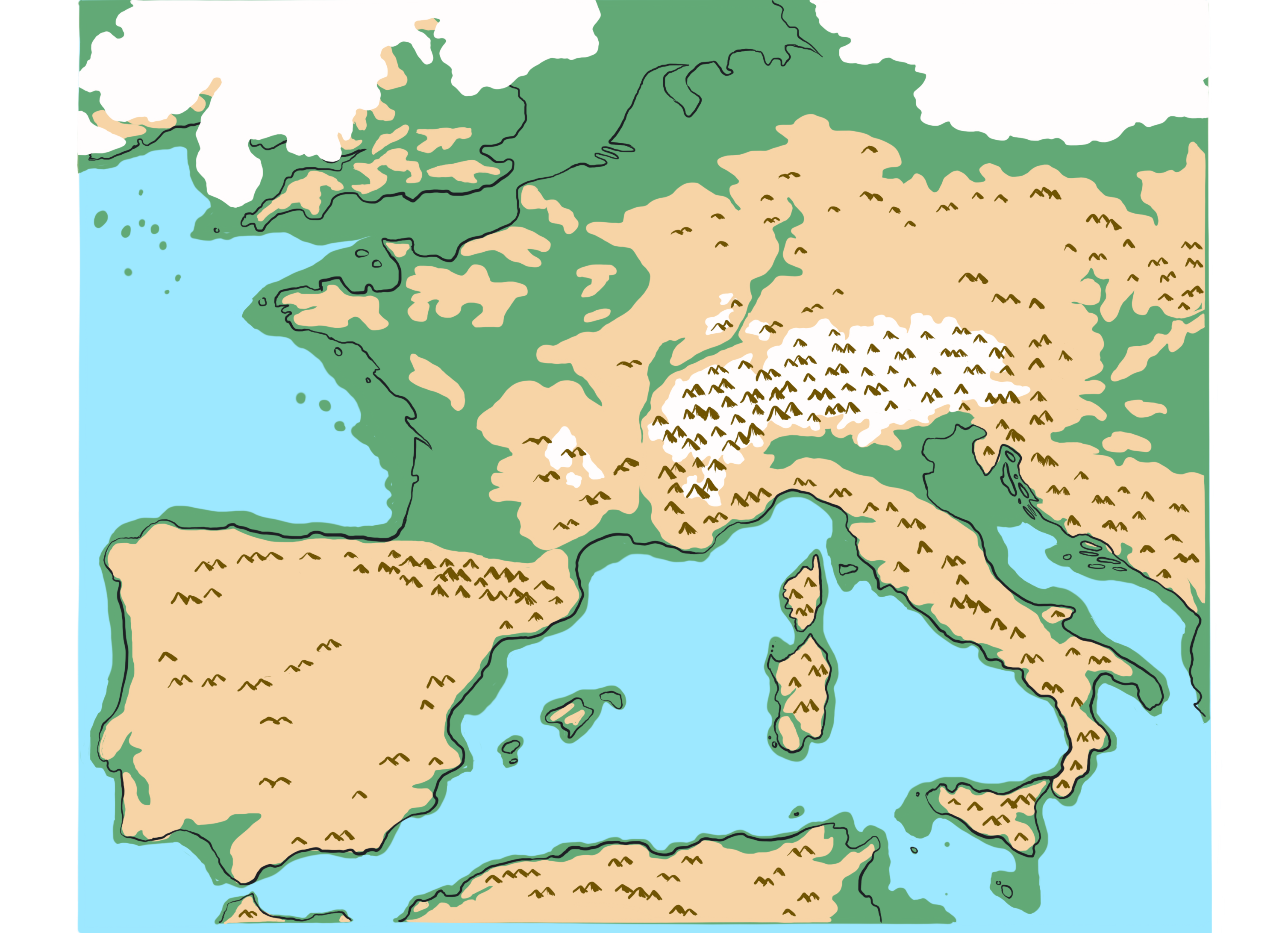
Armorican Massif:
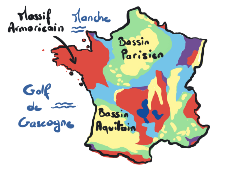
Masculine noun A collection of geological formations dating back to the Proterozoic and Paleozoic eras, observable in western France (Brittany, western Normandy, the Channel Islands, Pays de la Loire, and part of the Deux-Sèvres department) (adapted from Ballèvre et al., 2013).
The rocks associated with these formations are visible in areas where superficial layers (soils, sands, alluvium, etc.) are absent or have been removed — these are known as outcrops. These natural (cliffs, rock formations, rock slabs, caves, etc.) or artificial (road cuts, quarries, tunnels, trenches, etc.) outcrops have made it possible to define the geological geography of the Armorican Massif.
The boundaries of the Armorican Massif coincide with terrains of more recent geological ages (Mesozoic and Cenozoic eras). To the north, these boundaries lie beneath the waters of the English Channel; to the west, under the Bay of Biscay; to the east, in the Paris Basin; and to the south, in the Aquitaine Basin.
A Very Long History...
The history of the Armorican Massif is complex because it dates back to extremely ancient times and involves multiple former continents that have moved relative to one another. Simplified to its essentials, this history can be outlined as follows (inspired by Ballèvre et al., 2013):
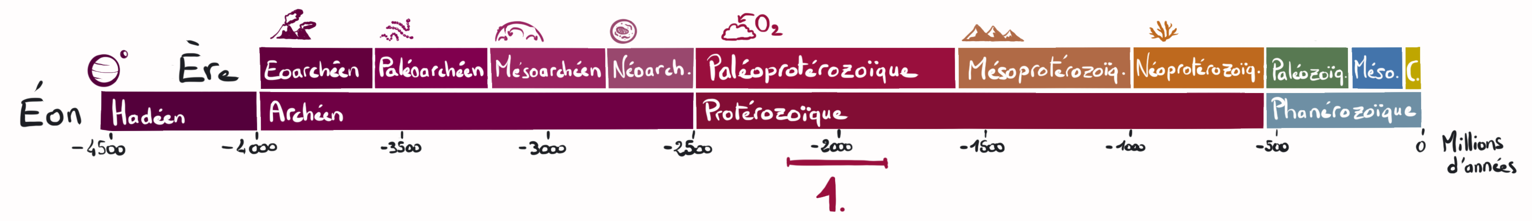
1 Between 2.2 and 1.8 billion years ago.
Somewhere on Earth, rocks that originally crystallized from cooling magma began to deform under increasing pressure and temperature. These are the oldest rocks in France! Unfortunately, they are too ancient for their original location to be determined.
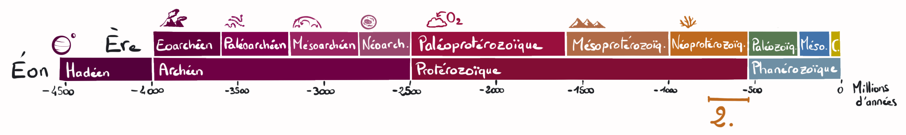

2 From 750 to 540 million years ago – The Cadomian Orogeny. This mountain range formed in the Southern Hemisphere as a tectonic plate bearing an ocean (the Iapetus Ocean) subducted beneath another plate carrying a large continent (Protogondwana). Rock deformation and the formation of new rocks were concentrated along the northern margin of the protogondwanan continent. The landmass that would become Gondwana included what are now parts of Africa, South America, southern Europe, Antarctica, southern Asia, Madagascar, Australia, New Guinea, India, Florida, and more.
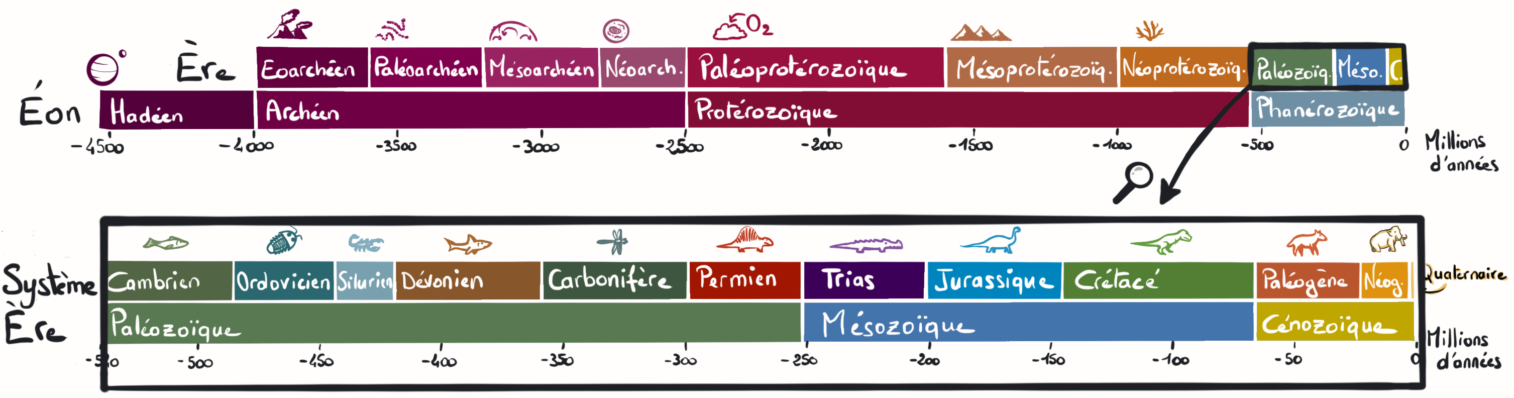
Note: This marks the transition from the Proterozoic Eon to the Phanerozoic Eon. A closer look at the Phanerozoic is necessary to better follow the next stages in the Armorican Massif’s history.
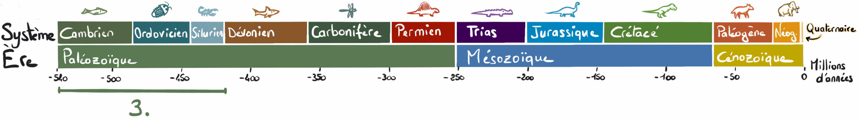
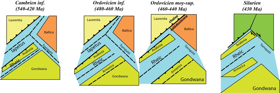
3 From 540 to 420 million years ago. A portion of Gondwana was located beneath the Antarctic Circle. This segment of the Earth’s crust stretched, thinned, and broke apart. Rocks formed mainly in marine settings, either from volcanic activity or from sediments eroded from the Cadomian mountain range. On the opposite side of the Iapetus Ocean, the oceanic plate subducted beneath a continent further north: Laurentia. This subduction gradually pushed fragments of Gondwana northward.
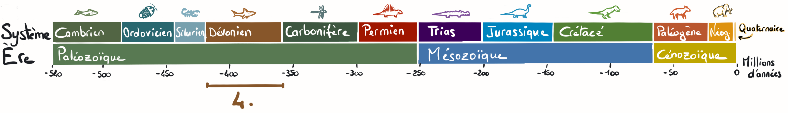

4 From 420 to 360 million years ago. Continued subduction beneath Laurentia eventually closed the Iapetus Ocean. This was due to the collision of a former Gondwanan fragment called Avalonia (still debated) with the Laurussia continent (comprising Laurentia and Baltica to the east). In the collision zone, rising pressure and temperature once again deformed and metamorphosed rocks, while magma generation created new ones. To the south, marine environments like the Rheic Ocean and the smaller Galicia–Massif Central Ocean continued to accumulate sedimentary rocks.
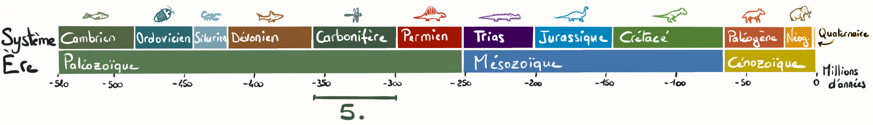

5 From 360 to 300 million years ago – The Hercynian (Variscan) Orogeny. The Rheic and Galicia–Massif Central oceans eventually closed due to the collision of Laurussia–Avalonia with Gondwana. This tectonic convergence created a vast mountain chain across the supercontinent Pangaea, near the equator.
At the heart of this orogeny — known as the Hercynian or Variscan mountain range — rising pressure and temperature again caused deformation and metamorphism. Part of the Earth’s crust melted, generating magma that rose toward the surface.
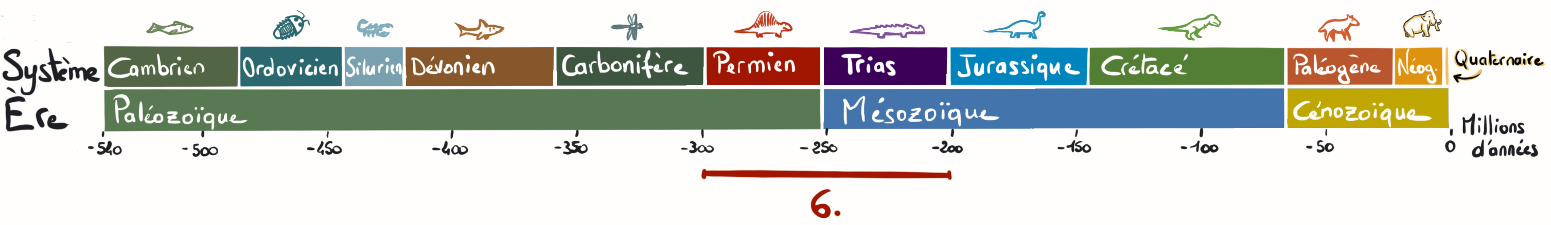
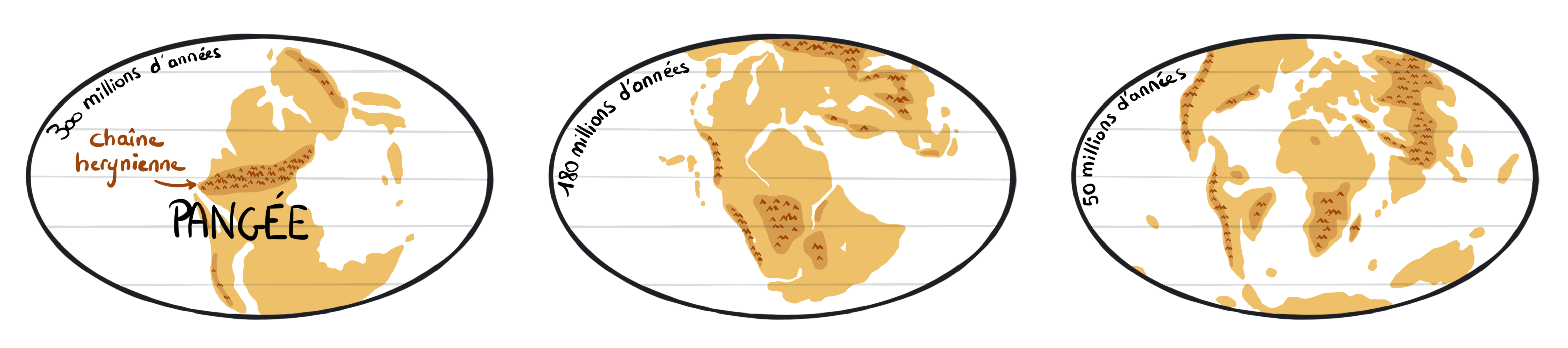
6 round 300 million years ago. The Hercynian (Variscan) relief began to erode due to the effects of rain, wind, and ice. The mountain chain gradually lost elevation. Simultaneously, isostatic rebalancing led to crustal thinning, and eventually Gondwana began to break apart, notably with the opening of the Atlantic Ocean about 200 million years ago. The drifting of the “Pangaea puzzle” pieces was once again driven by tectonic plate movements.
In the case of the Armorican Massif, the drift was consistently northward.
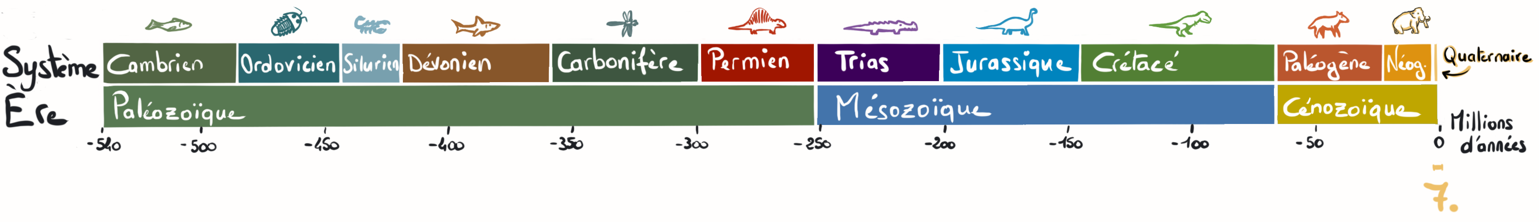
7 During the last 3 million years. The Armorican Massif had already reached the latitude it occupies today. This period was marked by alternating glacial and interglacial cycles every 100,000 years or so, causing significant changes in climate and sea levels. Freeze–thaw weathering and marine erosion during interglacials reshaped the landscape and led to the formation of many of the superficial deposits currently found above the Massif’s bedrock.
Conclusion
The age and complexity of the Armorican Massif’s history explain the great mineralogical diversity observed in this geological unit. The collection presented in this virtual museum illustrates this through its many rock and mineral varieties.